


Shorouk Express

For free real time breaking news alerts sent straight to your inbox sign up to our breaking news emails
Sign up to our free breaking news emails
Sign up to our free breaking news emails
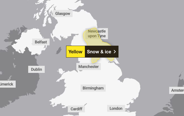
A yellow weather warning for ice and snow has been issued across parts of the UK this weekend.
Forecasters said Yorkshire and the Humber, northwest England and northeast England will be affected between 6am and 2pm on Saturday.
A Met Office spokesperson said: “Outbreaks of rain, sleet and snow are likely to develop early Saturday before easing from the west during the afternoon.
“Snow is more likely to the east of the Pennines, particularly above 150 metres, where 2 to 5cm may accumulate over the North York Moors and Northumberland.
“There is also a risk of ice over the Pennines, particularly above 200 metres where freezing rain is possible.”
open image in gallery
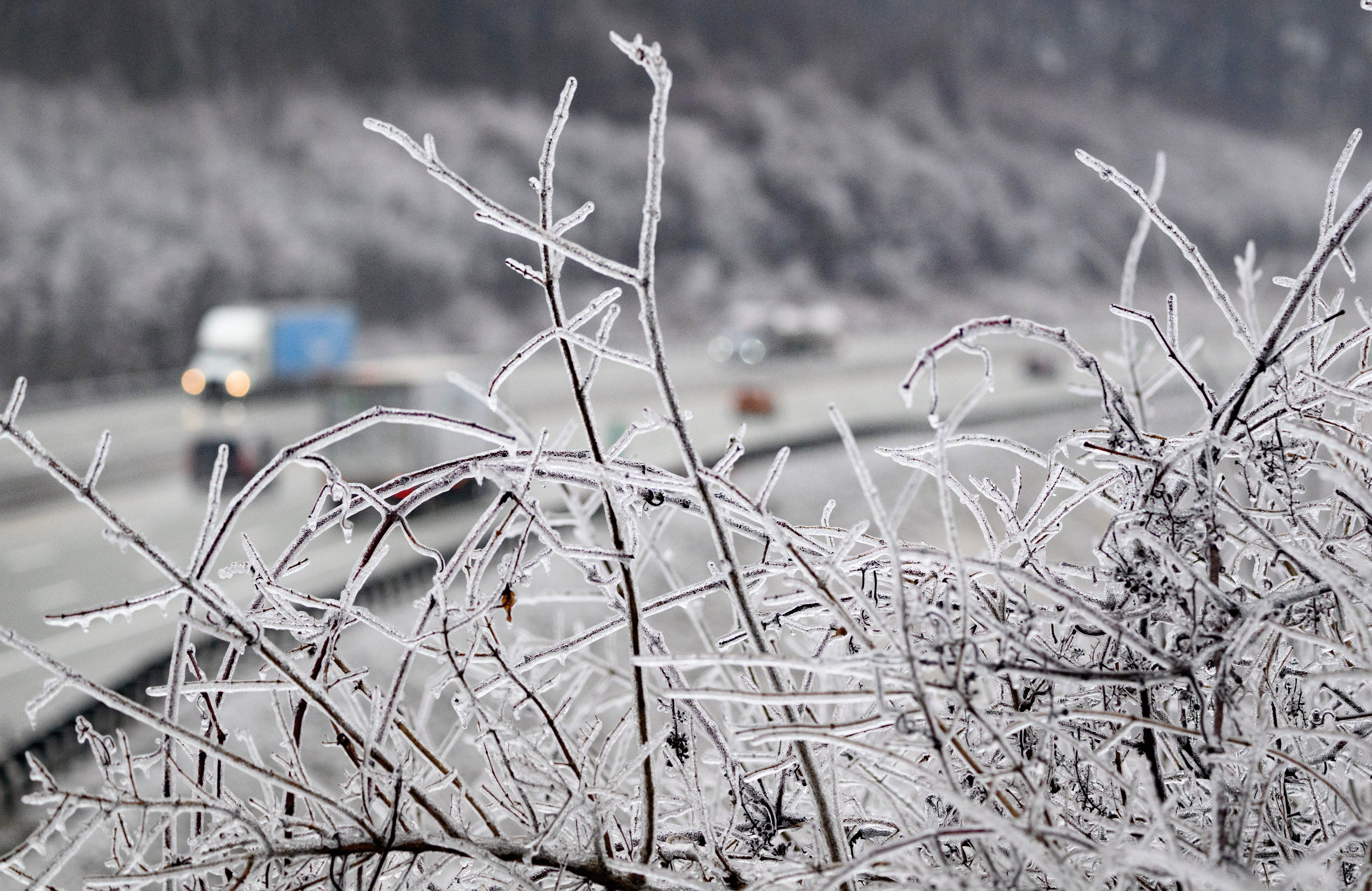
Freezing rain – commonly known as ice storms in North America – is not often seen in the UK because the conditions needed for it are quite specific.
It is rainfall that has become “supercooled” as it falls from the sky, travelling through various temperatures in the atmosphere.
It starts as sleet or hail high up in the atmosphere, but as it travels down it melts through a layer of warmer air, then refreezes again through a layer of colder air near the surface.
The Met Office warned the wintry weather could cause traffic delays and make driving “dangerous”.
It urged people to drive ahead and check for any road closures before setting out. Pedestrians are urged to try to use pavements along the main roads to avoid slipping.
open image in gallery
Freezing rain could be seen in Britain over the coming days, as high pressure to the north and east of the country continues to bring in cloud and cold air.
It can produce striking effects, forming as rain drops spread out momentarily across a surface before freezing and encasing the surface in a layer of clear ice.
The weight of the ice can sometimes be heavy enough to bring down trees and power lines, and the glaze of ice on the ground effectively turns roads and pathways into an ice rink, according to the Met Office.
It can also prove extremely hazardous for aircraft, with the chance of icicles forming across the wings of an aeroplane.
The ice is very clear, often referred to as black ice, because it is so difficult to see, making it treacherous for pedestrians and drivers.


