


Shorouk Express 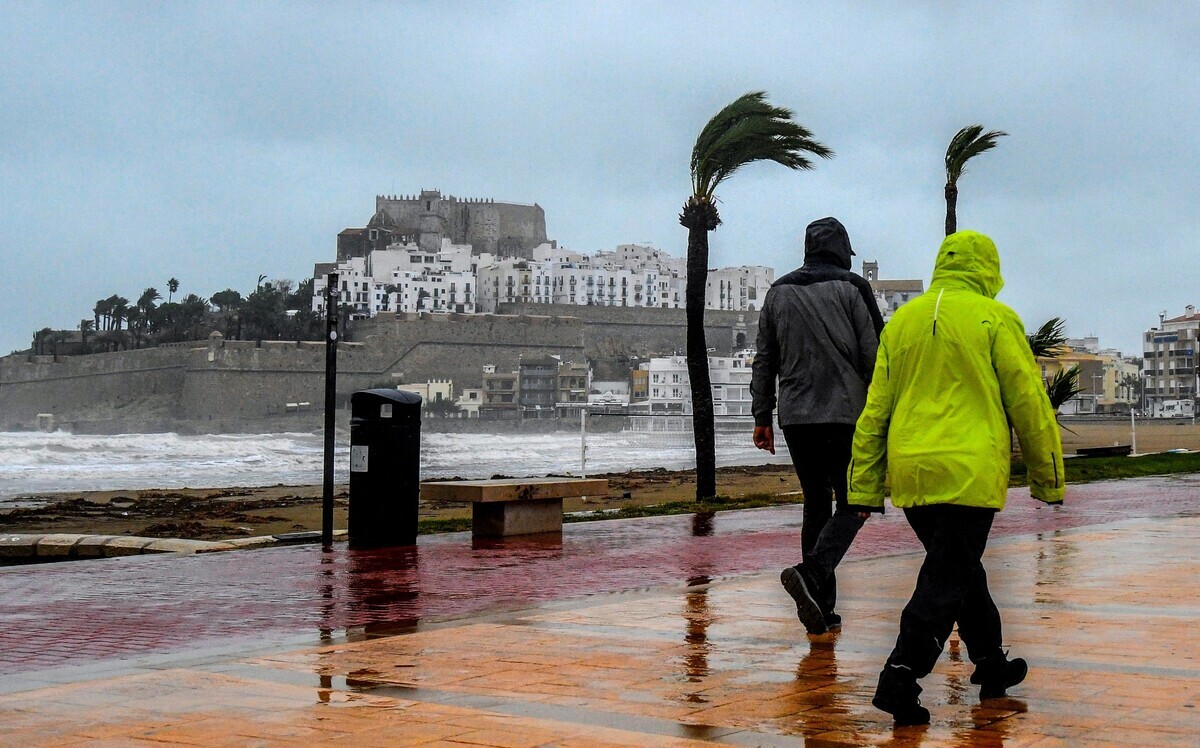
Another storm is forecast to arrive in Spain on Monday, putting several regions on weather alert and continuing the heavy rains that have soaked much of the country in recent weeks.
Heavy rain is set to continue in Spain this week, with the arrival of another stormy weather front putting several regions of the country on weather alert.
Following la borrasca Konrad hitting much of Spain with rain, strong winds and snow last week, from Monday storm Laurence will bring further wet weather to large parts of the country.
Orange and yellow-level weather warnings have been activated in seven regions. The rain, forecast to be particularly heavy in parts of Extremadura and Andalusia, notably the Málaga area, is also expected in Castile y León, Castile-La Mancha, Madrid, the Basque Country, Aragón, Valencia and Murcia.
Andalusia is under orange alert for heavy rainfall, while Castile y León, Castile-La Mancha, Extremadura, Madrid and Valencia have a yellow warning.
READ ALSO: What’s a ‘borrasca’ in Spain and how is it different from a DANA?
Storm Laurence will approach from the west with weather fronts that will leave very cloudy or overcast skies across much of the peninsula, as well as rainfall that will affect most of the southern half of the country, particularly in southwestern areas.
“Orange (significant danger) for rain in Málaga and strong waves in the Canary Islands. Yellow for snow, rain, storms, minimum temperatures, fog, thaws, wind and waves.” wrote Spain’s state meteorological agency Aemet on social media on Monday.
In the Canary Islands, the tail end of the cold front is also likely to bring light rainfall in the north and eastern islands.
Advertisement
However, despite the storm, maximum temperatures will increase across most of the Atlantic side of the peninsula, notably along the Cantabrian Sea area, but will decrease in the southeast of the peninsula and the archipelagos.
Minimum temperatures will increase in the Canary Islands, the south and west of the peninsula, as well as in the northeast, with no major changes in the rest of the country.
Light winds will increase to moderate, with southerly and westerly breezes on the Atlantic coast, while the rest of the country and the Balearic Islands will face easterly winds.
Intervals of strong or very strong wind gusts are forecast on the Cantabrian coast and in the Gulf of Cádiz.
The Canary Islands will see moderate winds from the north.
Advertisement
In Catalonia on Monday, cloudy intervals with morning mists and fog patches are forecast in parts, with rain likely in the early hours of the morning in the north-eastern part of the region. Temperatures will remain unchanged or rise slightly.
Madrid continues to be cloudy or overcast, with the possibility of mist and fog banks in the mountains throughout the day. Light rain and showers are forecast throughout the region. Minimum temperatures will remain unchanged and maximum temperatures will change little.
The Valencia region is predicted to have cloudy or very cloudy skies with light rainfall. Minimum temperatures aren’t expected to change except for slight increases in the southern part of the region, with maximum temperatures decreasing overall. Light frosts are forecast in inland areas of the northern half.
Neighbouring Murcia will have very cloudy skies with light to moderate rainfall. Minimum temperatures are forecast to rise and maximum temperatures fall.
The Balearic Islands will see cloudy intervals with occasional and isolated showers in Menorca and northeast of Mallorca in the early morning, increasing during the morning to cloudy or overcast, with light rainfall forecast.


