


Shorouk Express

For free real time breaking news alerts sent straight to your inbox sign up to our breaking news emails
Sign up to our free breaking news emails
Sign up to our free breaking news emails
A man has died in Ireland as the hurricane-force winds of Storm Eowyn continue to batter the British Isles.
Flights have been cancelled, roads closed and ferry services axed as winds surpassing 100mph hit parts of the UK and Ireland throughout Friday. Millions have also been left without power across the Isles due to the vicious storm.
A rare red weather warning was lifted on Friday from Scotland and Northern Ireland, where Storm Eowyn damaged buildings, uprooted trees and caused power cuts.
Follow our live blog for all the latest updates about Storm Eowyn
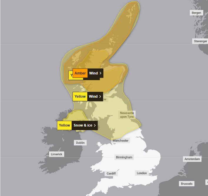
However, four weather warnings were in place for Friday evening, including an amber wind warnings for northern Scotland until 6am on Saturday, when gusts will reach up to 90mph.
A yellow wind warning covering northern England, parts of Northern Ireland and all of Scotland remains until the close of Friday.
Northern Ireland will see a yellow snow and ice warning lifted at 10am on Saturday.
open image in gallery
Forecasters are warning of flying debris resulting in danger to life, and travel disruption including flight cancellations are set to continue in areas affected by weather warnings.
There may also be further power cuts and continued damage to buildings and homes, the forecaster added.
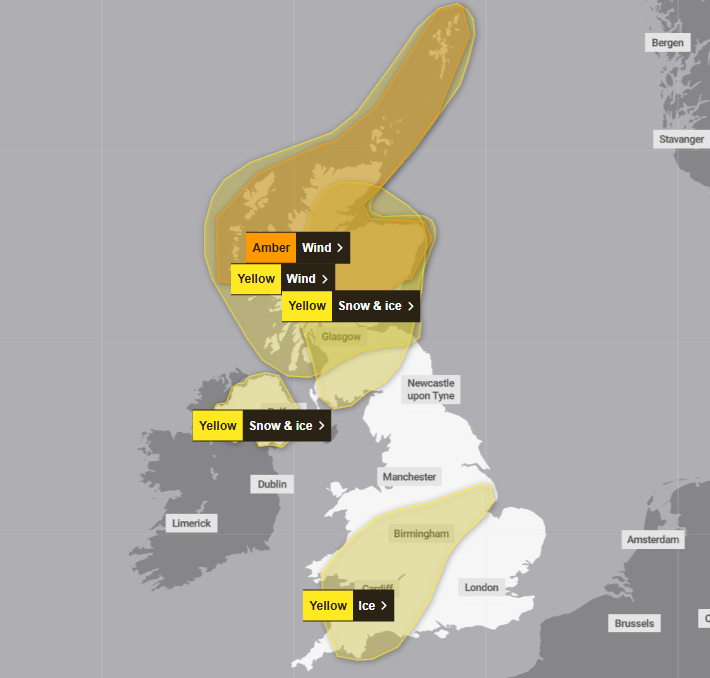
On Saturday, a yellow wind warning is in force across all Scotland barring the border region until 3pm, with wind gusts likely to peak at 80mph in Scotland’s northern isles.
A yellow snow and ice warning is also active for most of Scotland barring the western and northern coasts, with hazardous driving conditions likely as snowfall reaches up to 5-10cm.
From 3am until 10am on Saturday, a yellow ice warning covers parts of the Midlands, south west England and southern Wales. The Met Office says injuries will be possible due to slips on ice patches where roads and pavements are untreated.
open image in gallery
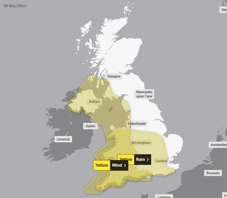
As the influence of Storm Eowyn diminishes as the system moves north and east on Saturday morning, an area of low pressure arriving from the southwest will bring significant rain on Sunday, the Met Office says.
Up to 20mm of rain is expected to fall widely on Sunday in areas under a yellow rain warning, which will cover most of the Midlands, Wales and southern England from 8am on Sunday until 6am on Monday. Flooding, travel disruption and power cuts are possible in the affected areas.
Another yellow wind warning will also be introduced for southwest and northwest England, Wales and Northern Ireland, lasting from 8am until 3pm on Sunday.
Met Office chief meteorologist Jason Kelly said: “The influence of Storm Éowyn on the UK’s weather will diminish as it moves further north and east on Saturday morning, but there’s little respite in the conditions for some with the next area of low pressure arriving from the southwest on Sunday.
open image in gallery
“While Sunday’s system doesn’t have the same strength as Eowyn, it will hamper some recovery efforts and bring further wind and rain, with the possibility of some flooding in places.
“10-20mm of rain will fall quite widely on Sunday in central and southern England, much of Wales and Northern Ireland, with 30-50mm possible over high ground. Thundery showers could top up totals later in the day for some.
“With this rain falling on saturated ground in many places, there’s a chance of flooding for some, with winds an accompanying hazard with the system.”
The change to conditions is being caused by a powerful jet stream pushing low pressure across the Atlantic and towards the UK, following a recent cold spell over North America, the Met Office said.


