Shorouk Express
Get the free Morning Headlines email for news from our reporters across the world
Sign up to our free Morning Headlines email
Sign up to our free Morning Headlines email

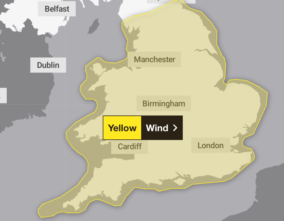
Most of England and Wales is facing a wet and windy start to the week with gusts of up to 70mph possible under a weather warning that is active until Monday evening.
Strong winds developed in coastal parts of South West England and Wales on Sunday and will spread widely inland by Monday morning.
A yellow weather warning came into force at 8pm on Sunday and will run until 6pm on Monday, covering most of England and Wales except the north of the Lake District and far North East.
Those under the warning zone are likely to feel 45 to 55mph west or south-westerly gusts and exposed locations could see these reach 70mph, the Met Office said.
open image in gallery
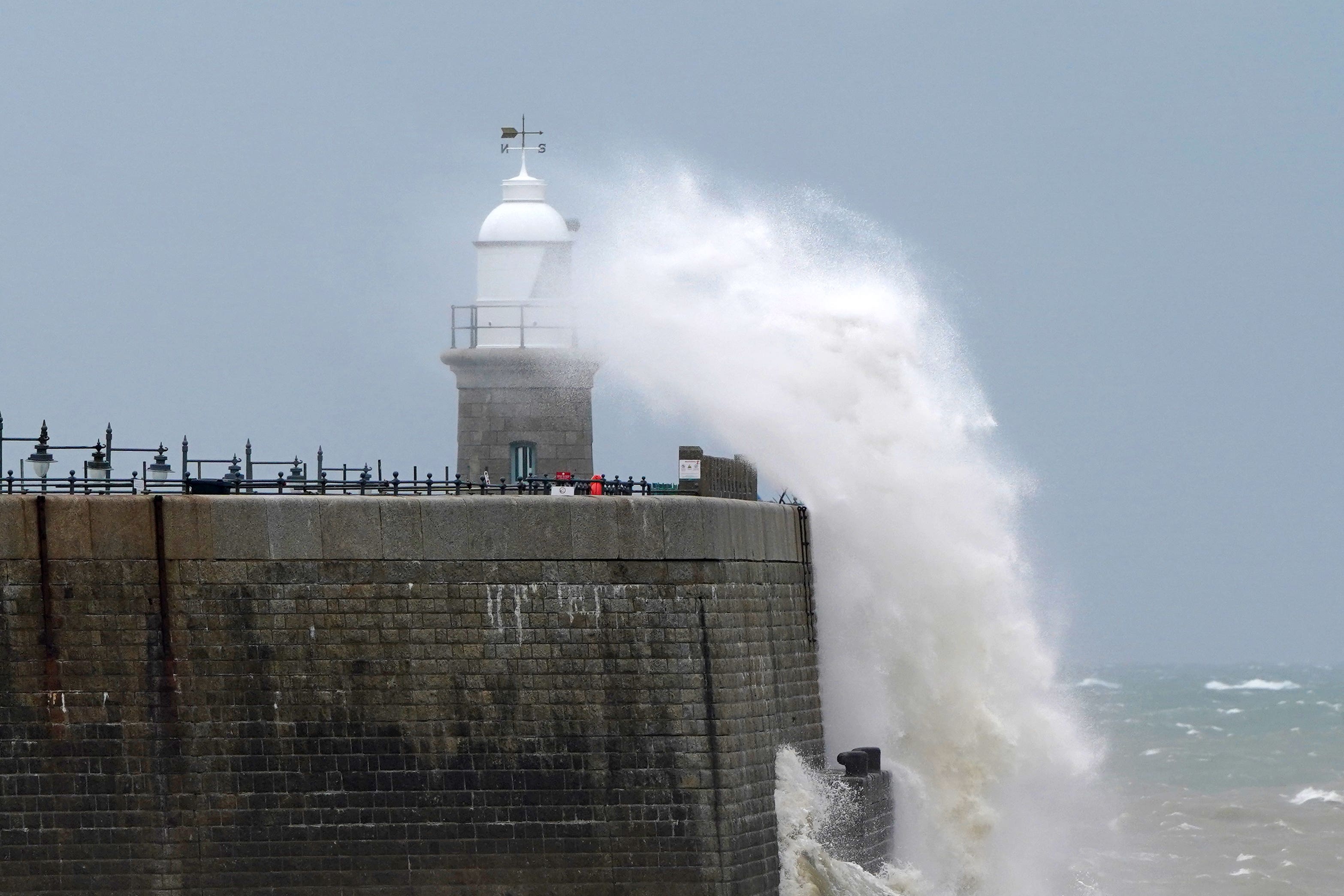
Some communities near coastal routes and sea fronts may be affected by large waves.
Forecasters said those affected should prepare to protect their property and people from injury. They recommend checking for loose items outside the home and planning how to secure items such as bins, garden furniture, trampolines, tents, sheds and fences.
They also advise checking road conditions and bus and train timetables, and amending travel plans if necessary to have the best chance of avoiding delays.
open image in gallery
Despite the unpredictable conditions, forecasters said they are not expecting a named storm to hit the country.
Met Office meteorologist Tom Morgan said there could be “low impacts in general” but added: “Nonetheless, there could be some brief kind of power interruptions and some travel disruption for the return to work on Monday morning.
“So it will be quite a windy start to the week. Gales certainly possible for many parts of England and Wales, perhaps even severe gales on Irish Sea coasts.
“The strongest winds are expected to be for west Wales and North West England on Monday morning.”

open image in gallery
He added that Monday will be “a windy and pretty unsettled start to the week with a mixture of sunny spells and heavy blustery showers”, mainly in England and Wales, but there will be “some fairly brisk winds at times further north as well”.
The coming week will bring “changeable” conditions with periods of wind and rain throughout.
Mr Morgan said: “The ground has started to become fairly wet over recent weeks and it will not take a huge amount more for there to be some surface water, potentially some flooding issues as we go towards the middle part of the week.”
In preparation for the rough weather, people have been encouraged to secure loose items outside their properties and gardens from the forceful blasts.
They should also check for delays and road closures and be careful along coastal regions, the Met Office said.